


Future-proofed large-scale residential development
A substantial block of rural farmland identified for large-scale residential development along with supporting commercial usage has been placed on the market for sale.
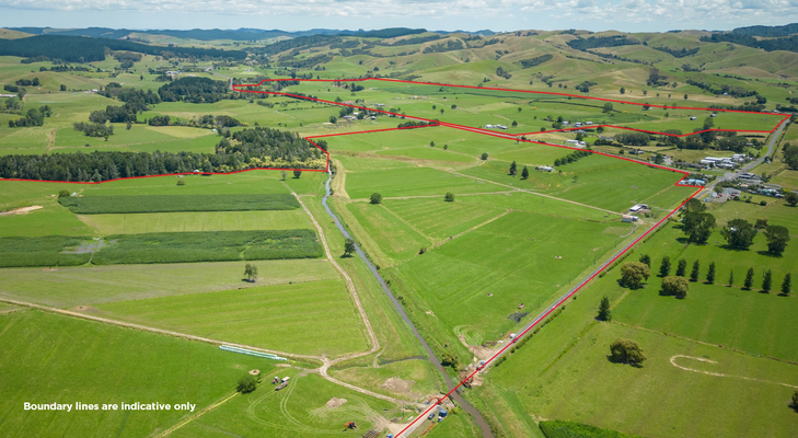
The 170-hectare farming block at the base of the Firth of Thames just south-east of Auckland is currently zoned Rural 1A under the Hauraki District Plan, but has been identified for future large-scale residential development alongside supporting commercial and industrial building amenities and infrastructure.
The property is located at 165 and 244 State Highway 25 in Waitakaruru on the main arterial route connecting Auckland and comprises 14 individual titles ranging in size from 2.83 hectares to 36.58 hectares.
The size and scale of the predominantly flat block mean it would be an ideal location for development of a master-planned community – replicating the likes of Pokeno and Ohinewai in the Northern Waikato, which have both emerged virtually ‘from scratch’ as huge new townships over the past decade.
The 170-hectare development block at Waitakaruru is being marketed by sale by negotiation through Bayleys Waikato. Salesperson Josh Smith said unrelated circumstances clearly indicated the most likely and sensible option for development of the site – subject to council consenting from a regional authority keen to see solutions for alleviating the area’s housing predicament.
“The flooding events evidenced in the Hauraki Plains and Coromandel regions earlier this year have highlighted the need for building new settlements situated above flood plains and river channels. The blocks for sale at 165 and 244 State Highway 25 are predominantly elevated and away from the coast,” Smith said.
“Many coastal settlements along the Coromandel Peninsula, and the low-lying areas within the Hauraki Plains were severely impacted by those floods, so both property owners, and the respective regional councils, are now identifying locations where there will be little to no impact from projected sea level rises and extreme flooding in the coming generations. Waitakaruru meets that requirement to defy the extreme weather events currently being experienced on a regular basis.
“Within the block being marketed for sale is an elevated vantage which gives eastern views across to the Firth of Thames with the backdrop of the Coromandel Ranges, while to the west is a vista of the rolling farmlands of Mangatarata. The property’s location is immediately adjacent to the highway linking Auckland to the Coromandel Peninsula.
“Feedback from developers who have already investigated the property is that there is scope for approximately 93 hectares of elevated land to be allocated for residential use, while some four hectares of land straddling the state highway would suit the likes of a commercial and light industrial service centre suitable for sustaining shops, cafes, schools, day care facilities, and even healthcare amenities,” Smith said.
“Additionally, approximately 12 hectares of flat land is prime for light industrial use, leaving some 40 hectares for the creation of parks and reserves suitable for handling any run-off or rainfall sustained in major weather events such as Cyclone Gabrielle or the flooding seen earlier this year.”
Smith said the opportunity to create a substantial residential enclave at Waitakaruru would alleviate residential development pressures in Thames by creating a new township in a lifestyle orientated rural location within a short commuting distance. Thames is located some 25 kilometres away, while other smaller towns within easy commuting distance from the property include Ngatea, Paeroa, and Kerepehi.
“Concurrently, the Government’s passing of the Fast-track Approvals Amendment Act at the end of last year will see the streamlining of applications requiring consent under the Resource Management Act. This will enable developers to meet the needs for new master-planned housing destinations at scale in a far quicker timeframe than previously… which is particularly attractive for any new owner of the land at 165 and 244 State Highway 25,” he said.